Reteach: Observe Before You Infer

Use a precise observation

Point to a printed feature first. Useful stems: “This map labels …”; “Next to … I see …”. A statement about why or when a physical change happened usually needs more than one observation.
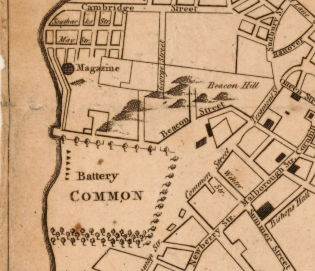
Tan, monochrome map detail with COMMON, Beacon Street, Cambridge Street and Beacon Hill labels. A heavy curved boundary runs along the left side of the Common. Small tree symbols line parts of the Common; streets and blocks appear to its right and above.

A new and correct plan of the town of Boston. Published in London in 1775 (October, according to the catalog); creator unnamed in the catalog. Library of Congress, Geography and Map Division. Detail from the original map. Source: https://www.loc.gov/item/2018590109/

Reteach: earlier evidence

Finish “This map shows …” with a label and its relationship to COMMON. Underline the words that tell where you looked.

Your response
1

Reteach: Observe Before You Infer

Connect observations without overclaiming

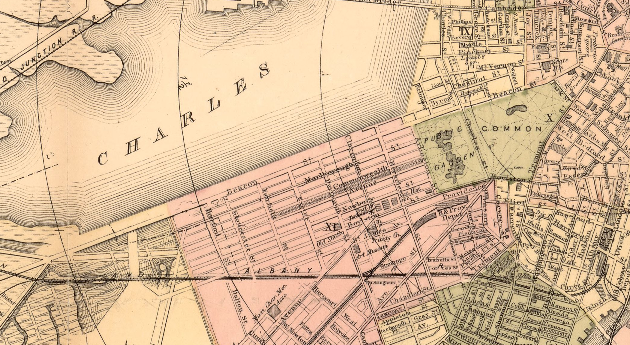
Use this detail with the preceding one. Locate the Common and Beacon Street in each. Compare near these anchors, while allowing for the wider coverage of the later detail.

Colored map detail with PUBLIC COMMON and PUBLIC GARDEN at right, CHARLES across a large area with parallel lines at upper left, and Beacon St, Marlborough St and Commonwealth Avenue in a street grid between them. Lines, blocks, labels and folds overlap in places.

Map of Boston for 1883. Sampson, Davenport & Co., Boston, 1883. The print also has a separate 1882 copyright-entry date. Library of Congress, Geography and Map Division. Detail from the original map. Source: https://www.loc.gov/item/76692216/

Reteach: observation and inference

Write one observation from this map. Then write an inference about a difference near the Common using that observation and your earlier-map observation. Finish “This does not tell me …” with a specific limit.

Your response

2