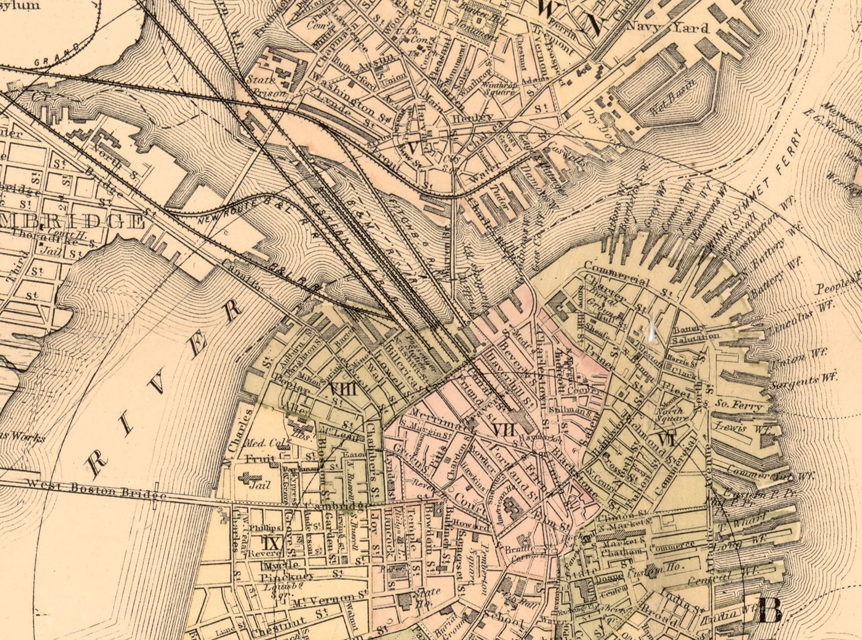
Work with the evidence in this packet. Read the source cards and map details before explaining a change. Locate Mill Pond and the Prince/Salem/Hanover street network to its right.
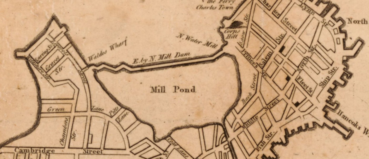
A new and correct plan of the town of Boston. Published in London in 1775 (October, according to the catalog); creator unnamed in the catalog. Library of Congress, Geography and Map Division. Detail from the original map. Source: https://www.loc.gov/item/2018590109/
Mill Pond: earlier observation
Describe the labeled area Mill Pond and one neighboring labeled street or boundary. Keep observation separate from explanation.
Your response